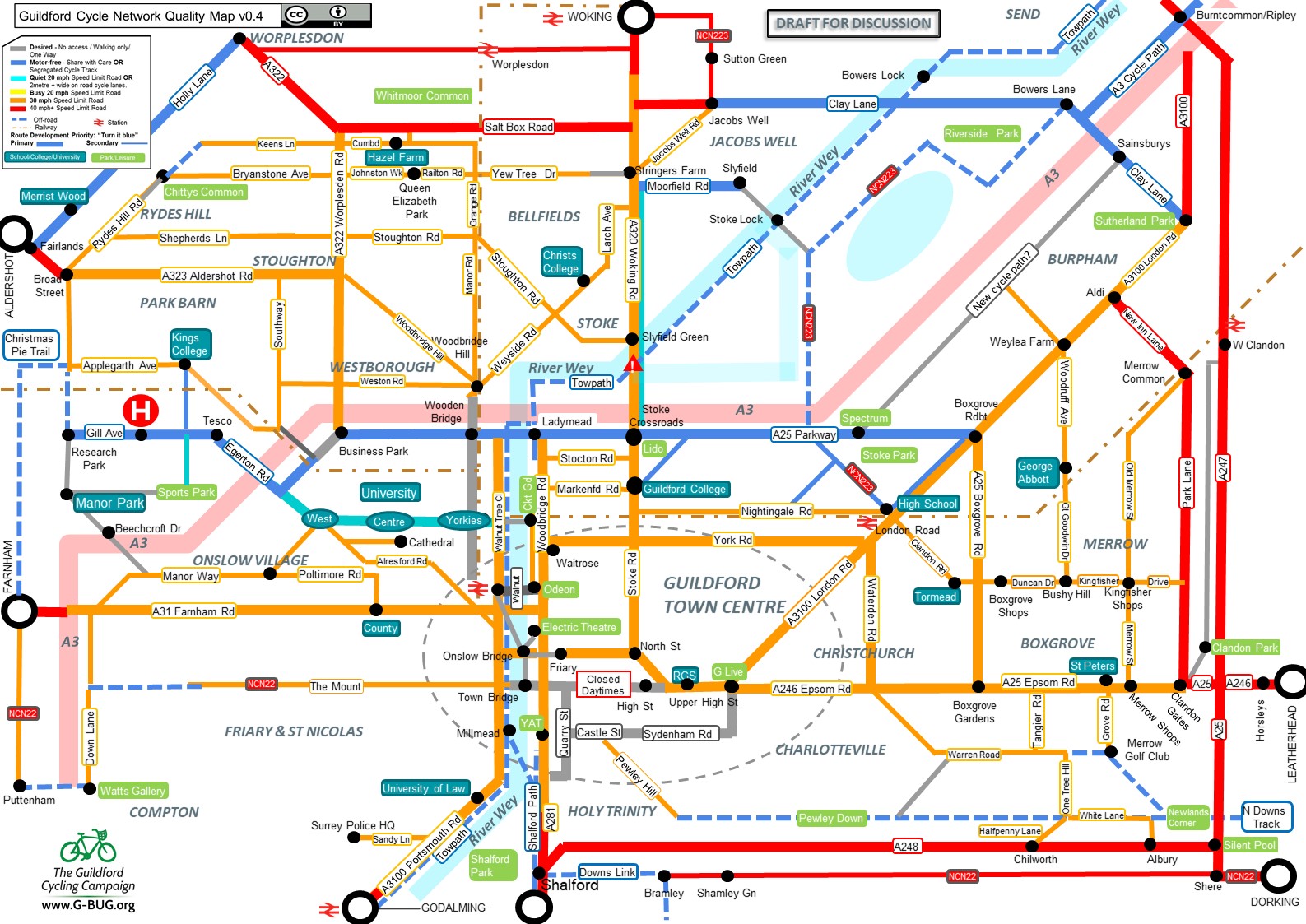
Cycle routes local to Guildford include:
Surrey County Council has a useful web page on cycle routes across the County.
Paper maps
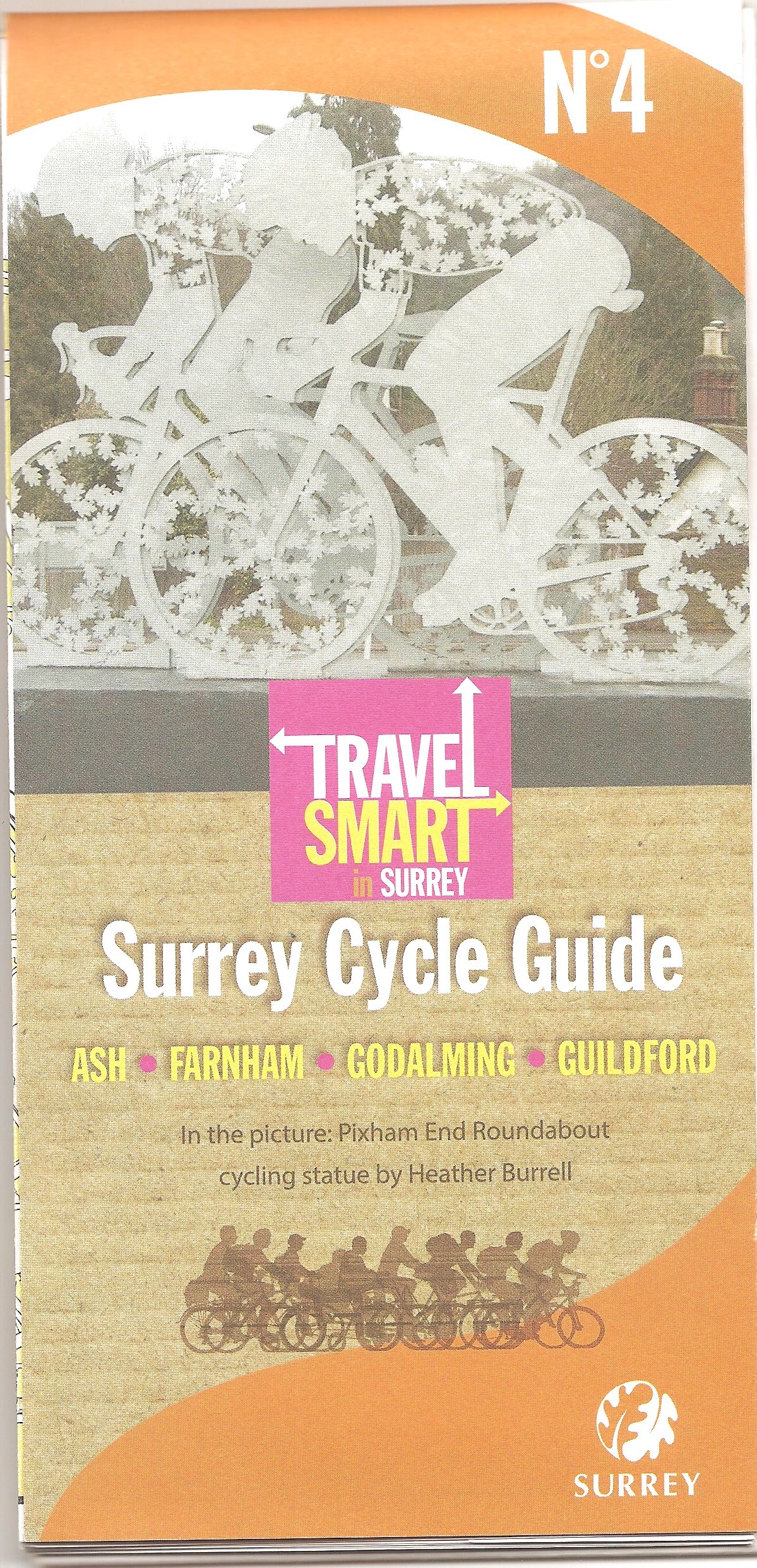
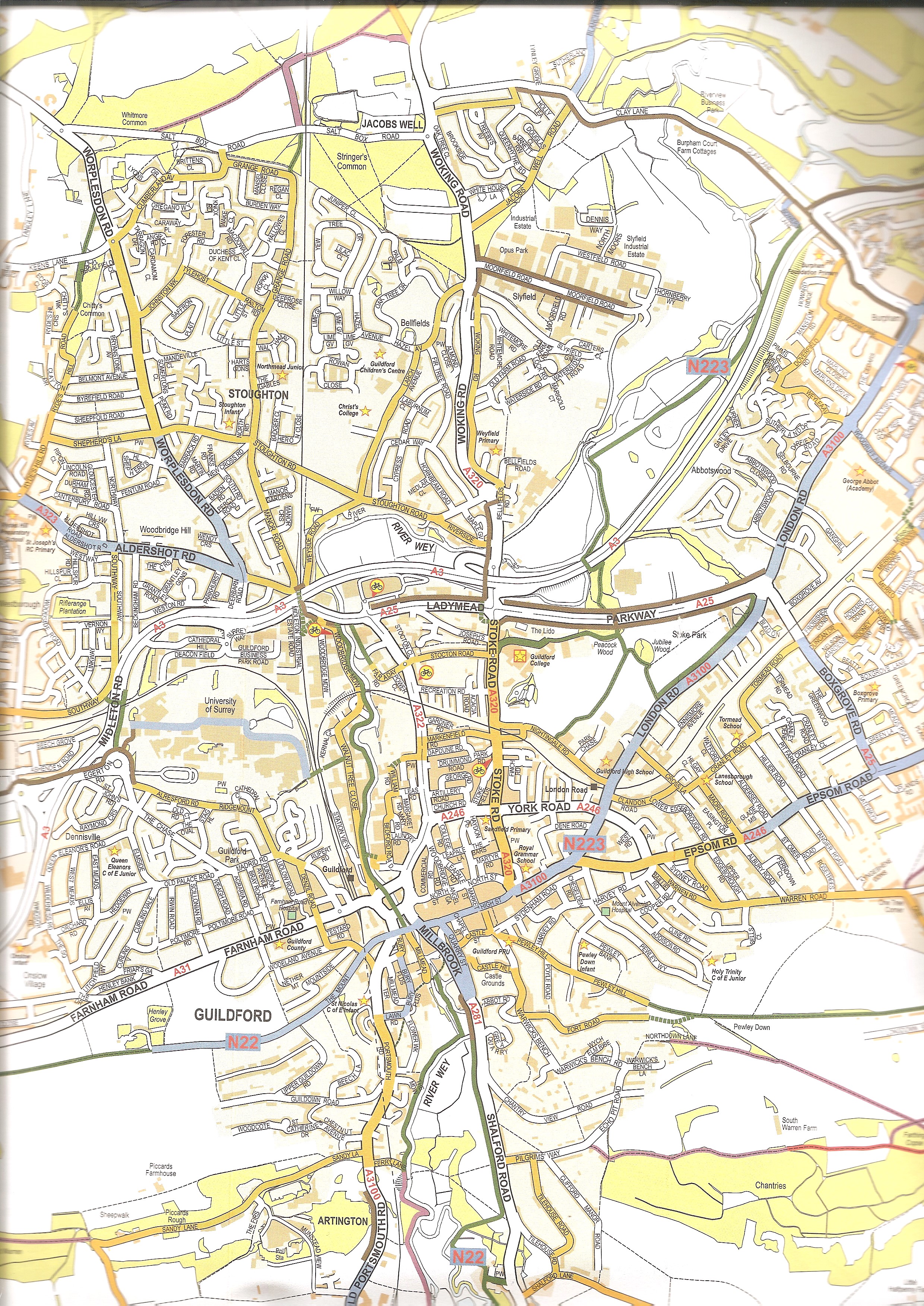
Surrey County Council issues an excellent series of maps for the County under the title ‘Surrey Cycle Guide‘: Map 4 includes Guildford. They are available free of charge from the central library and Tourist Information Centre, so get one while stocks last.
Guildford is surrounded by some beautiful countryside, much of it part of the Area of Outstanding Natural Beauty. Why not explore it by bike? Perhaps the best way to do this is to get a copy of the Ordnance Survey 1:25K Explorer Map Sheet 145 (or subscribe to the Ordnance Survey app). This will help you plan your own routes on quiet country lanes. You can also cycle on any bridleway or byway shown on the map. (You can browse the OS maps for free on Bing Maps: choose the OS layer and zoom in through 1:50K and 1:25K maps.)
Route planner
An excellent website for planning cycle routes on quiet(er) roads and paths is cycle.travel.
We need your help! To help GBUG campaign for safe cycling infrastructure, join our mailing list or email info@g-bug.org.